


Cannons Elementary Voting District, Spartanburg County, South Carolina
About
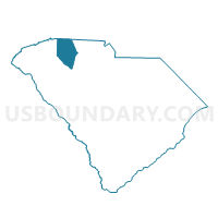
Outline

Summary
| Unique Area Identifier | 666705 |
| Name | Cannons Elementary Voting District |
| County | Spartanburg County |
| State | South Carolina |
| Area (square miles) | 6.88 |
| Land Area (square miles) | 6.83 |
| Water Area (square miles) | 0.05 |
| % of Land Area | 99.30 |
| % of Water Area | 0.70 |
| Latitude of the Internal Point | 35.00860670 |
| Longtitude of the Internal Point | -81.87844600 |
Maps


Graphs
Select a template below for downloading or customizing gragh for Cannons Elementary Voting District, Spartanburg County, South Carolina


Neighbors
Neighoring Voting District (by Name) Neighboring Voting District on the Map
- Cherokee Springs Fire Station Voting District, Spartanburg County, SC
- Converse Fire Station Voting District, Spartanburg County, SC
- Cowpens Fire Station Voting District, Spartanburg County, SC
- Drayton Fire Station Voting District, Spartanburg County, SC
- Eastside Baptist Voting District, Spartanburg County, SC
- Whitlock Jr. High Voting District, Spartanburg County, SC
Top 10 Neighboring County Subdivision (by Population) Neighboring County Subdivision on the Map
- Spartanburg CCD, Spartanburg County, SC (115,412)
- Boiling Springs CCD, Spartanburg County, SC (23,368)
- Mayo CCD, Spartanburg County, SC (5,310)
- Cowpens CCD, Spartanburg County, SC (4,388)
Top 10 Neighboring Unified School District (by Population) Neighboring Unified School District on the Map
- Spartanburg School District 2, SC (58,308)
- Spartanburg School District 7, SC (52,943)
- Spartanburg School District 3, SC (16,629)
Top 10 Neighboring State Legislative District Lower Chamber (by Population) Neighboring State Legislative District Lower Chamber on the Map
Top 10 Neighboring State Legislative District Upper Chamber (by Population) Neighboring State Legislative District Upper Chamber on the Map
Top 10 Neighboring 111th Congressional District (by Population) Neighboring 111th Congressional District on the Map
Top 10 Neighboring Census Tract (by Population) Neighboring Census Tract on the Map
- Census Tract 224.03, Spartanburg County, SC (7,920)
- Census Tract 223.02, Spartanburg County, SC (5,310)
- Census Tract 222.01, Spartanburg County, SC (4,605)
- Census Tract 222.02, Spartanburg County, SC (4,388)
- Census Tract 214.03, Spartanburg County, SC (3,514)
- Census Tract 214.02, Spartanburg County, SC (3,410)
- Census Tract 213.01, Spartanburg County, SC (2,646)
- Census Tract 214.01, Spartanburg County, SC (1,578)